Glamis Guide / A Day In The Dunes

Nine moments, one app.

A day in the dunes.

From the drive in to the ride home, this is how Glamis Guide fits a day at the Imperial Sand Dunes, with or without a signal.

Download on the App Store

Chapter 1

Check The Weather On The Way

Before the pavement ends, open the Weather card: conditions, wind with gusts, and sunset for the dunes, not the nearest town. The last forecast stays on your phone after the signal is gone.
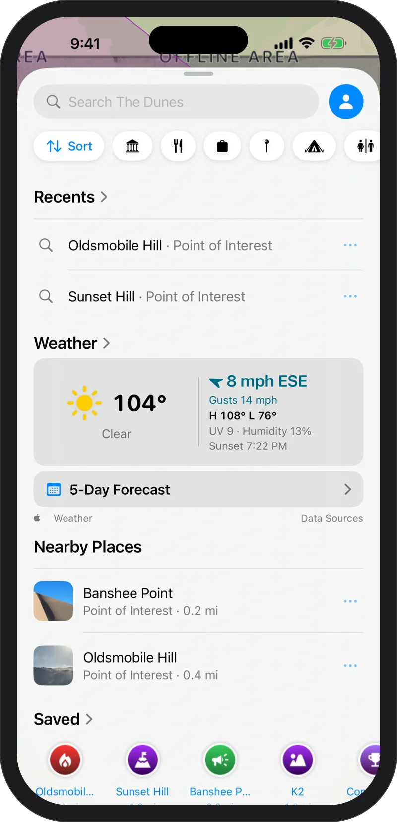
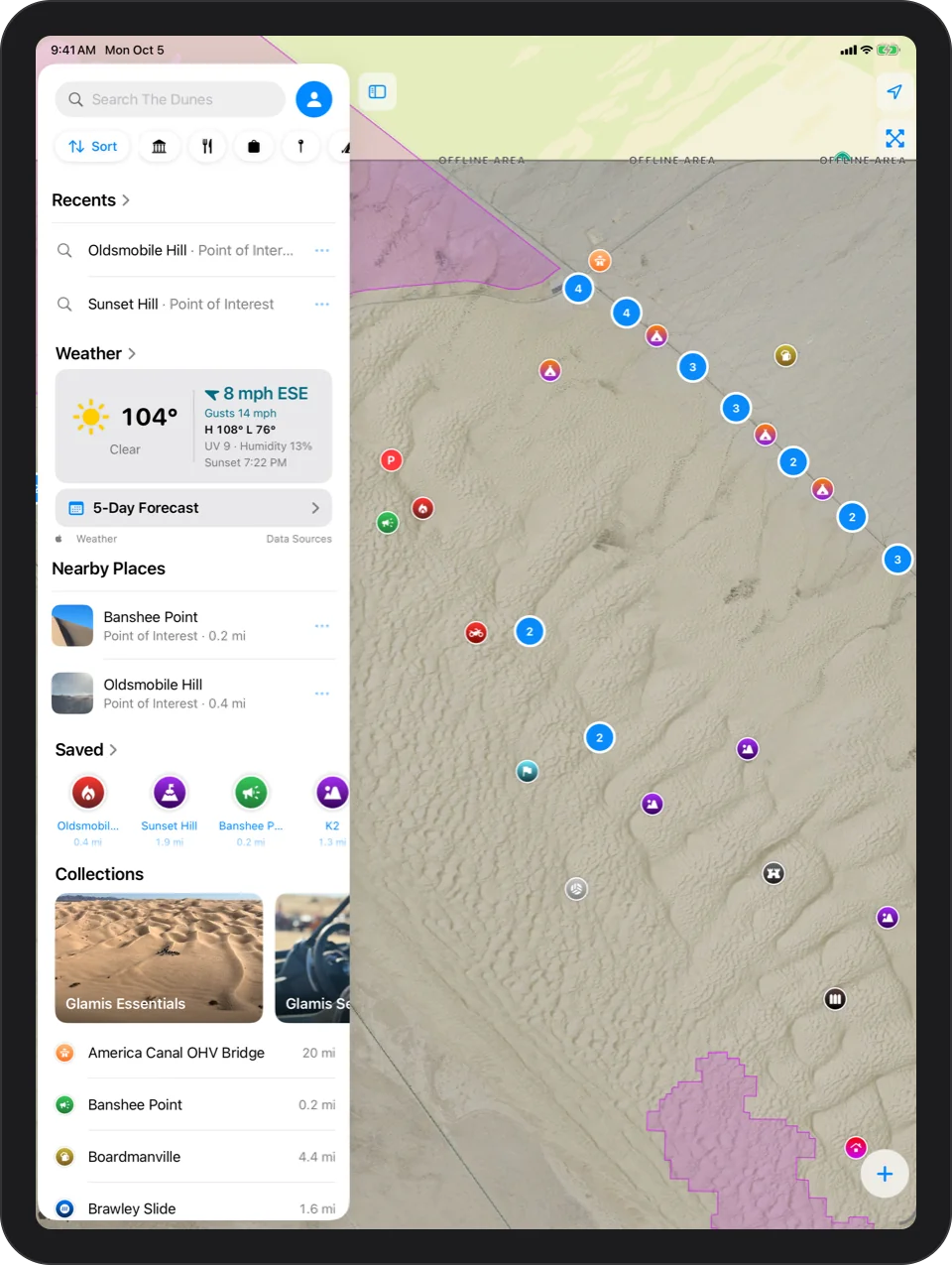
Glamis weather

iPhone: the Weather card on Explore: clear, 104°, wind 8 mph ESE with gusts, high and low, UV index, humidity and sunset time, with a 5-Day Forecast buttoniPad: the Weather card on Explore: clear, 104°, wind 8 mph ESE with gusts, high and low, UV index, humidity and sunset time, with a 5-Day Forecast button

Chapter 2

Navigate To Camp

Pick your wash or pad and Glamis Guide draws a straight line to it, with live distance and a compass. Out here there are no roads, so there are no turns.
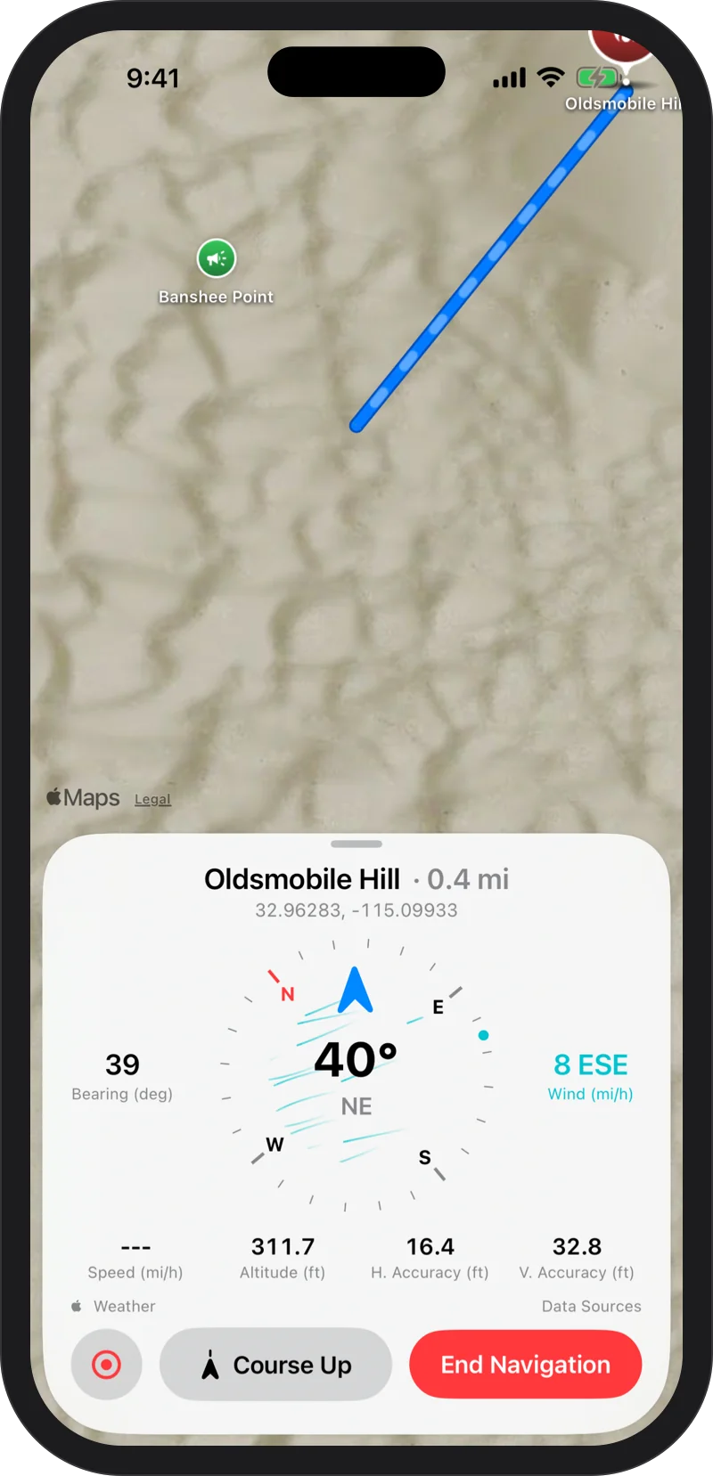
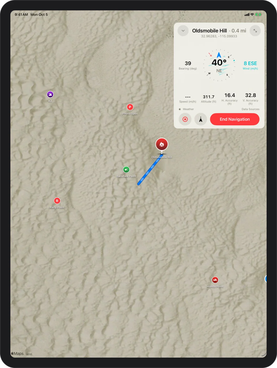
How navigation works

iPhone: navigating to Oldsmobile Hill: a straight blue line across the map, a large compass with the heading, bearing, wind, speed and altitude readouts, and Course Up and End Navigation buttonsiPad: navigating to Oldsmobile Hill: a straight blue line across the map, a large compass with the heading, bearing, wind, speed and altitude readouts, and Course Up and End Navigation buttons

Chapter 3

Mark Camp

Park, tap once, and your camp is saved where you stand. From now on, camp is one tap away from the app, a widget, Siri or your watch.
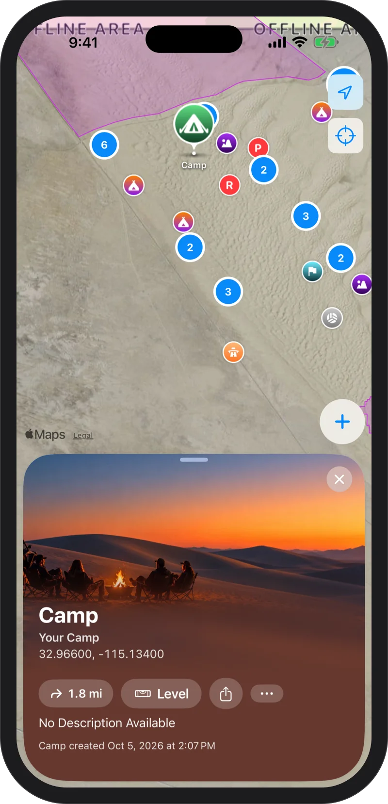
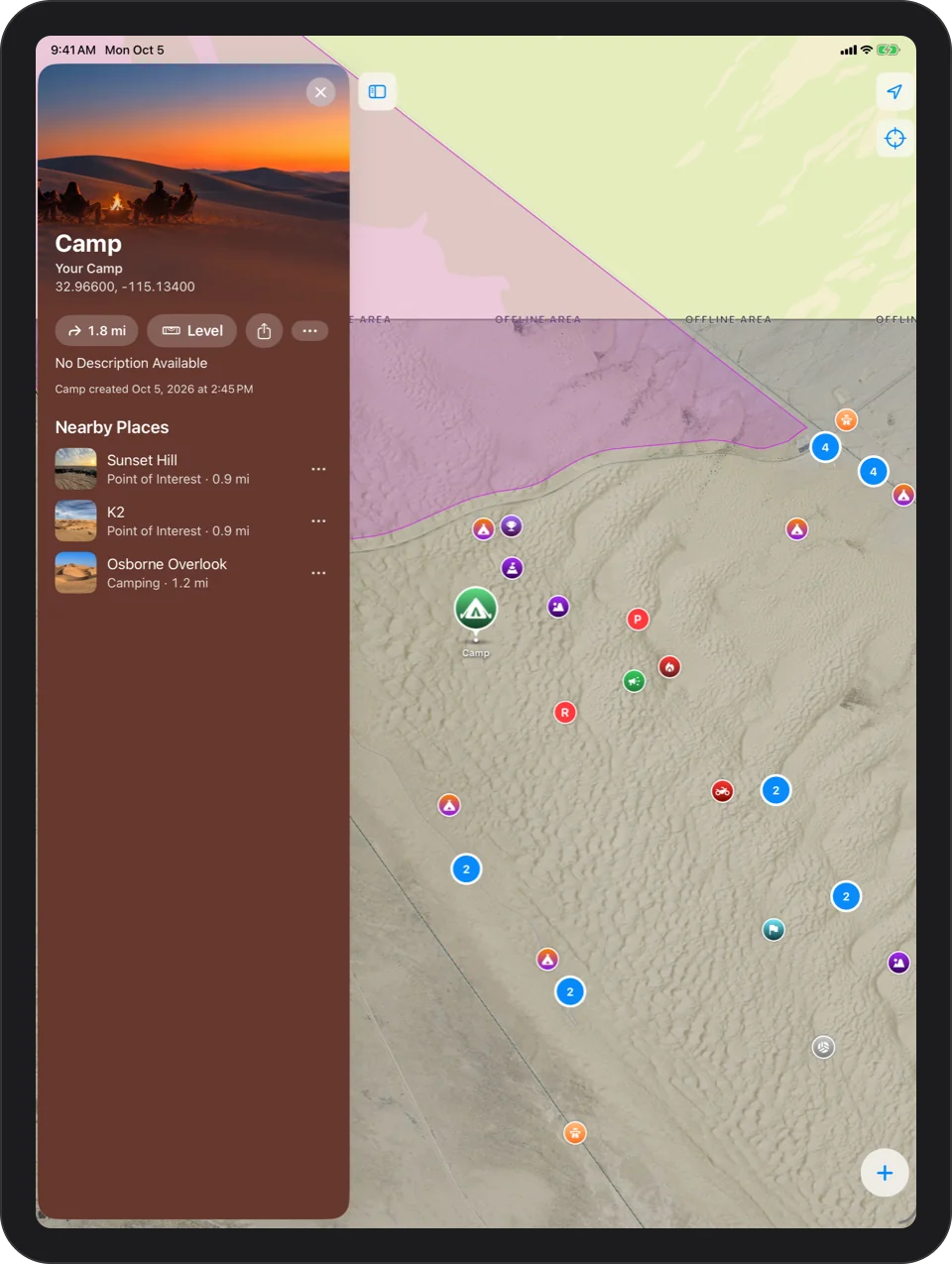
About Mark Camp

iPhone: the camp card: a green tent pin labeled Camp on the map, with the camp photo, Your Camp, its coordinates, distance, Level and ShareiPad: the camp card: a green tent pin labeled Camp on the map, with the camp photo, Your Camp, its coordinates, distance, Level and Share

Chapter 4

Share Camp With The App Clip

Send camp to the rest of the group. Friends without the app still see the spot, how far away it is and which way to go, with nothing to install.
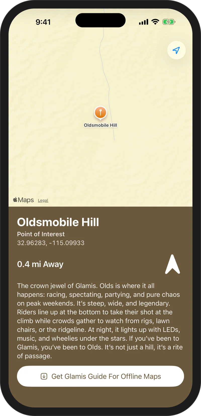
How sharing works

iPhone: the App Clip for a shared place: Oldsmobile Hill on a map, its distance away, an arrow pointing to it, and a button to get Glamis Guide for offline maps

Chapter 5

Level The RV

Lay your iPhone flat in the RV. It shows which side to raise and by how much, and with Apple Watch the reading follows you out to the jacks.
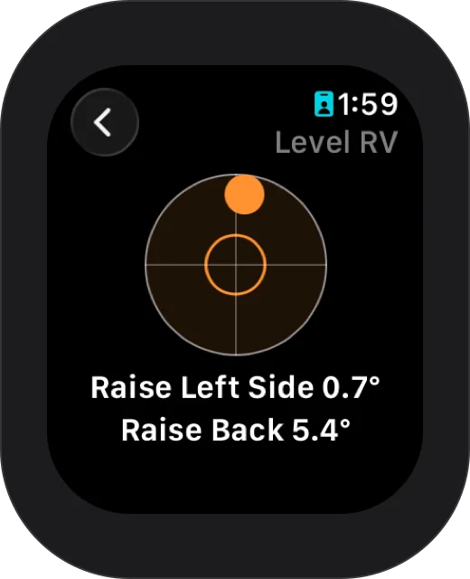
How leveling works

Apple Watch: Level RV with the bubble off center: Raise Left Side 0.7°, Raise Back 5.4°

Chapter 6

Head Out On A Ride

Leave the phone in the bag. Start Ride on Apple Watch keeps tracking you with your wrist down.
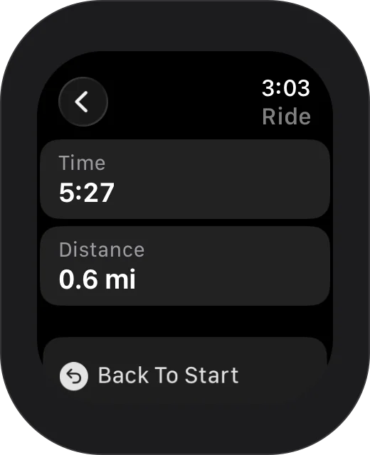
Glamis Guide on Apple Watch

Apple Watch: a ride in progress with elapsed time, distance and Back To Start

Chapter 7

Record It

Tap Record and ride. It keeps going with your phone locked, pauses on its own when you stop, and ends with distance, moving time, top speed and climb.
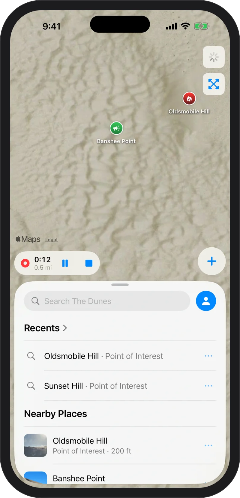
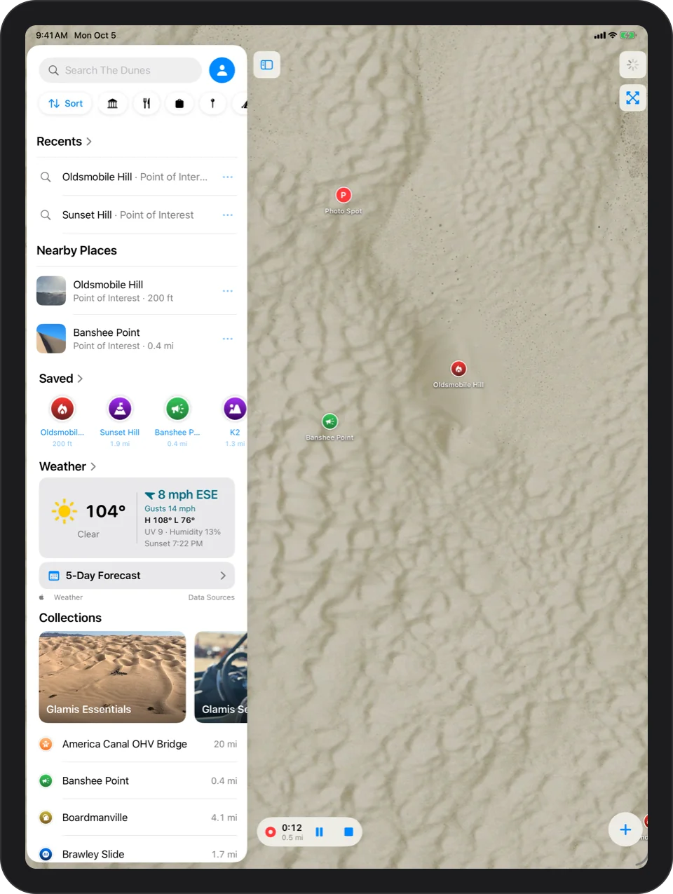
Record your ride

iPhone: recording a track: a small readout over the map with moving time and distance and Pause and Stop buttonsiPad: recording a track: a small readout over the map with moving time and distance and Pause and Stop buttons

Chapter 8

Retrace Your Steps

Any track becomes directions, start to end or end to start. Drift off it and the app lets you know.
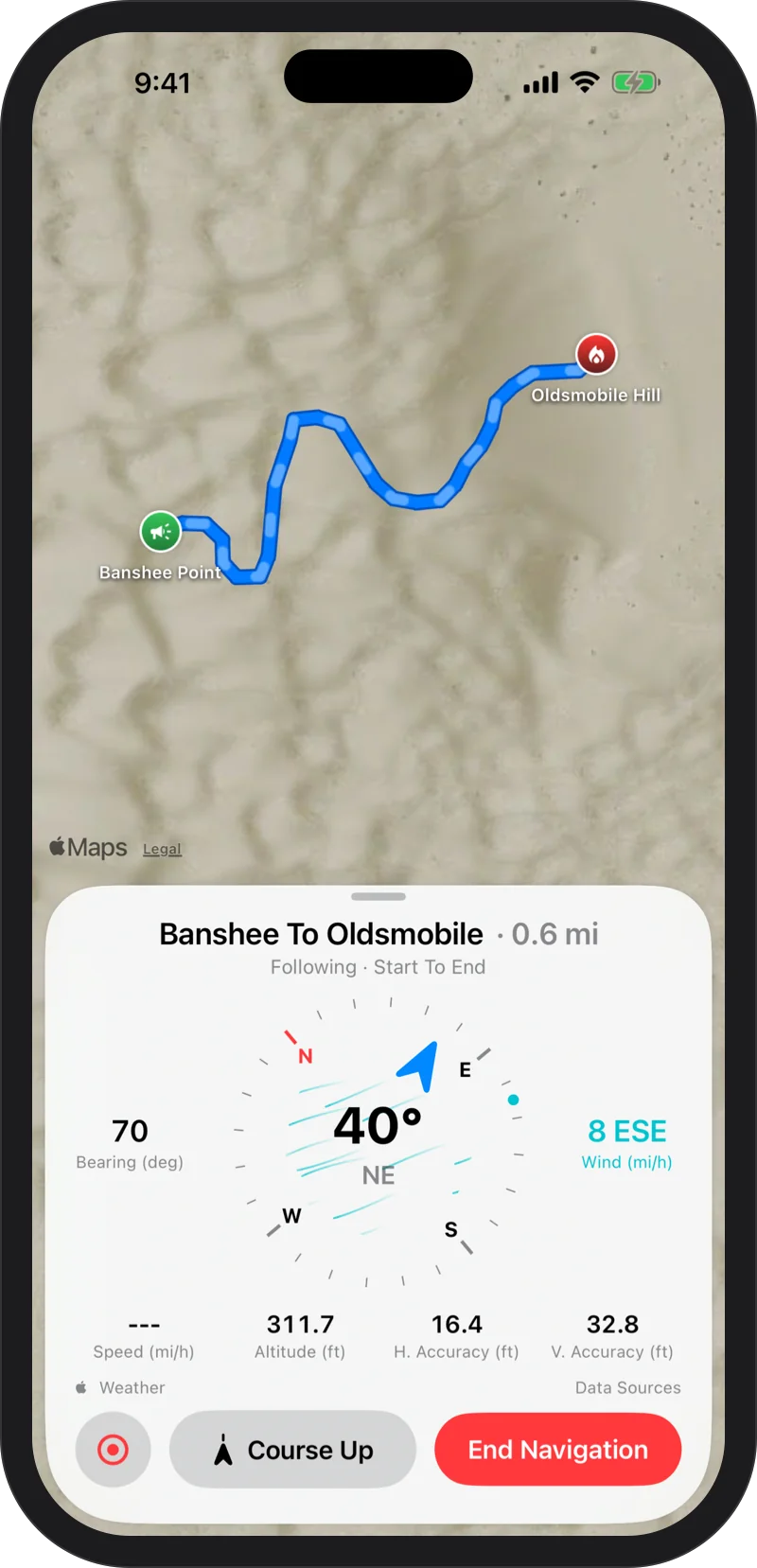
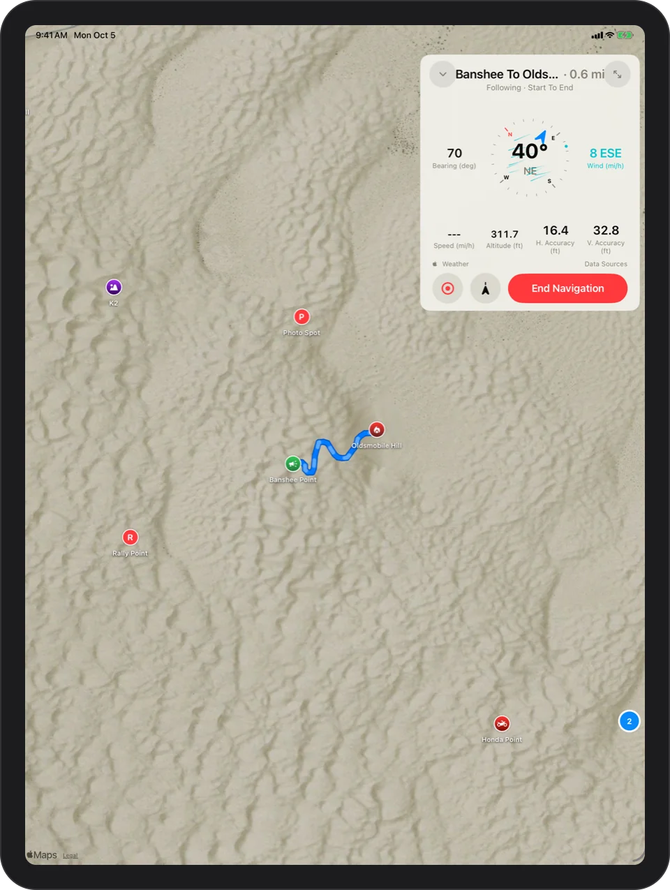
Following a track

iPhone: following a track start to end: the trail ahead in blue and the part already ridden fadediPad: following a track start to end: the trail ahead in blue and the part already ridden faded

Chapter 9

Navigate Back To Camp

When the light goes, follow the arrow home. Distance and direction to camp stay on your wrist and your Lock Screen until you are back.
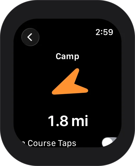

Getting back to camp

Apple Watch: a large orange arrow pointing to Camp, 1.8 mi away, with an On Course Taps switch

Every dune, offline.

Download on the App Store

Free on the App Store. Requires iOS 17 or later; the Apple Watch app requires watchOS 11 or later.